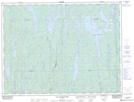
Maps showing Lac de l'Étang, Baie-James; Jamésie, Quebec
Lac de l'Étang is a Lake located in Baie-James; Jamésie, Quebec and has an elevation of 440 meters.
- Latitude: 49° 2' 40'' North (decimal: 49.0444444)
- Longitude: 74° 21' 30'' West (decimal: -74.3583333)
- Topography Feature Category: Lake
- Geographical Feature: Lac
- Canadian Province/Territory: Quebec
- Elevation: 440 meters
- Location: Baie-James; Jamésie
- Atlas of Canada Locator Map: Lac de l'Étang
- GPS Coordinate Locator Map: Lac de l'Étang Lat/Long
Lac de l'Étang NTS Map Sheets