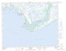
Maps showing Rivière de l'Étang, Côte-Nord-du-Golfe-du-Saint-Laurent; Basse-Côte-Nord, Quebec
Rivière de l'Étang is a River located in Côte-Nord-du-Golfe-du-Saint-Laurent; Basse-Côte-Nord, Quebec and has an elevation of 19 meters.
- Latitude: 50° 8' 33'' North (decimal: 50.1425)
- Longitude: 61° 31' 41'' West (decimal: -61.5280556)
- Topography Feature Category: River
- Geographical Feature: Rivière
- Canadian Province/Territory: Quebec
- Elevation: 19 meters
- Location: Côte-Nord-du-Golfe-du-Saint-Laurent; Basse-Côte-Nord
- Atlas of Canada Locator Map: Rivière de l'Étang
- GPS Coordinate Locator Map: Rivière de l'Étang Lat/Long
Rivière de l'Étang NTS Map Sheets