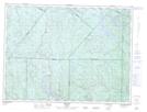
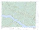
Maps showing Rivière Éternité, Rivière-Éternité; Le Fjord-du-Saguenay, Quebec
Rivière Éternité is a River located in Rivière-Éternité; Le Fjord-du-Saguenay, Quebec and has an elevation of 240 meters.
- Latitude: 48° 17' 57'' North (decimal: 48.2991945)
- Longitude: 70° 20' 2'' West (decimal: -70.3339552)
- Topography Feature Category: River
- Geographical Feature: Rivière
- Canadian Province/Territory: Quebec
- Elevation: 240 meters
- Location: Rivière-Éternité; Le Fjord-du-Saguenay
- Atlas of Canada Locator Map: Rivière Éternité
- GPS Coordinate Locator Map: Rivière Éternité Lat/Long
Rivière Éternité NTS Map Sheets