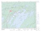
Maps showing Rivière Faribault, Baie-James; Jamésie, Quebec
Rivière Faribault is a River located in Baie-James; Jamésie, Quebec and has an elevation of 368 meters.
- Latitude: 50° 0' 39'' North (decimal: 50.0108333)
- Longitude: 74° 24' 2'' West (decimal: -74.4005556)
- Topography Feature Category: River
- Geographical Feature: Rivière
- Canadian Province/Territory: Quebec
- Elevation: 368 meters
- Location: Baie-James; Jamésie
- Atlas of Canada Locator Map: Rivière Faribault
- GPS Coordinate Locator Map: Rivière Faribault Lat/Long
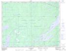
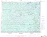
Rivière Faribault NTS Map Sheets