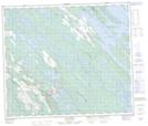
Maps showing Lac Fauves, Lac-Vacher; Caniapiscau, Quebec
Lac Fauves is a Lake located in Lac-Vacher; Caniapiscau, Quebec and has an elevation of 485 meters.
- Latitude: 54° 55' 37'' North (decimal: 54.9270509)
- Longitude: 66° 44' 16'' West (decimal: -66.7378754)
- Topography Feature Category: Lake
- Geographical Feature: Lac
- Canadian Province/Territory: Quebec
- Elevation: 485 meters
- Location: Lac-Vacher; Caniapiscau
- Atlas of Canada Locator Map: Lac Fauves
- GPS Coordinate Locator Map: Lac Fauves Lat/Long
Lac Fauves NTS Map Sheets