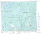
Maps showing Lac Fold, Fermont; Caniapiscau, Quebec
Lac Fold is a Lake located in Fermont; Caniapiscau, Quebec.
- Latitude: 52° 49' 15'' North (decimal: 52.8209098)
- Longitude: 67° 17' 15'' West (decimal: -67.2874397)
- Topography Feature Category: Lake
- Geographical Feature: Lac
- Canadian Province/Territory: Quebec
- Location: Fermont; Caniapiscau
- GPS Coordinate Locator Map: Lac Fold Lat/Long
Lac Fold NTS Map Sheets