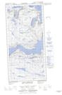
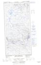
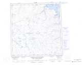
Maps showing Pointe Ford, Rivière-Koksoak; Kativik, Quebec
Pointe Ford is a Cape located in Rivière-Koksoak; Kativik, Quebec and has an elevation of 28 meters.
- Latitude: 61° 35' 54'' North (decimal: 61.5982670)
- Longitude: 72° 0' 47'' West (decimal: -72.0129187)
- Topography Feature Category: Cape
- Geographical Feature: Pointe
- Canadian Province/Territory: Quebec
- Elevation: 28 meters
- Location: Rivière-Koksoak; Kativik
- Atlas of Canada Locator Map: Pointe Ford
- GPS Coordinate Locator Map: Pointe Ford Lat/Long
Pointe Ford NTS Map Sheets