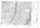
Maps showing Ruisseau de la Fourche, Mont-Valin; Le Fjord-du-Saguenay, Quebec
Ruisseau de la Fourche is a River located in Mont-Valin; Le Fjord-du-Saguenay, Quebec.
- Latitude: 49° 6' 12'' North (decimal: 49.1033737)
- Longitude: 71° 7' 41'' West (decimal: -71.1281307)
- Topography Feature Category: River
- Geographical Feature: Ruisseau
- Canadian Province/Territory: Quebec
- Location: Mont-Valin; Le Fjord-du-Saguenay
- Atlas of Canada Locator Map: Ruisseau de la Fourche
- GPS Coordinate Locator Map: Ruisseau de la Fourche Lat/Long
Ruisseau de la Fourche NTS Map Sheets