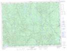
Maps showing Ruisseau Frey, Lac-Ashuapmushuan; Le Domaine-du-Roy, Quebec
Ruisseau Frey is a River located in Lac-Ashuapmushuan; Le Domaine-du-Roy, Quebec.
- Latitude: 48° 17' 26'' North (decimal: 48.2906031)
- Longitude: 72° 32' 14'' West (decimal: -72.5373541)
- Topography Feature Category: River
- Geographical Feature: Ruisseau
- Canadian Province/Territory: Quebec
- Location: Lac-Ashuapmushuan; Le Domaine-du-Roy
- Atlas of Canada Locator Map: Ruisseau Frey
- GPS Coordinate Locator Map: Ruisseau Frey Lat/Long
Ruisseau Frey NTS Map Sheets