Canada Topographic Maps

Rivière Gadois Topo Maps

Topography maps and Latitude/Longitude Location

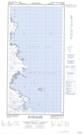
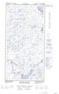
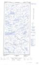
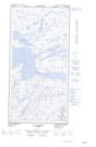
Maps showing Rivière Gadois, Rivière-Koksoak; Kativik, Quebec

Rivière Gadois is a River located in Rivière-Koksoak; Kativik, Quebec.

  • Latitude: 60° 18' 30'' North   (decimal: 60.3082582)
  • Longitude: 69° 45' 26'' West   (decimal: -69.7572373)
  • Topography Feature Category: River
  • Geographical Feature: Rivière
  • Canadian Province/Territory: Quebec
  • Location: Rivière-Koksoak; Kativik
  • Atlas of Canada Locator Map: Rivière Gadois
  • GPS Coordinate Locator Map: Rivière Gadois Lat/Long

Rivière Gadois NTS Map Sheets

025C05E Plover Islands Topographic Map at 1:50,000 scale

025C05W Plover Islands Topographic Map at 1:50,000 scale

025D08E Roberts Lake Topographic Map at 1:50,000 scale

025D08W Roberts Lake Topographic Map at 1:50,000 scale

025C Akpatok Island Topographic Map at 1:250,000 scale

025D Riviere Arnaud (Payne) Topographic Map at 1:250,000 scale

 
Buy Topographic Maps DVD
Newsletter Sign-up

Yes, I want to receive map store discounts.


Bookmark and Share