Canada Topographic Maps

Lac Gaillot Topo Maps

Topography maps and Latitude/Longitude Location

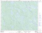
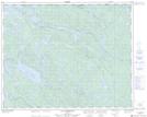
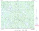
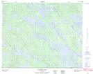
Maps showing Lac Gaillot, Lac-Jérôme; Minganie, Quebec

Lac Gaillot is a Lake located in Lac-Jérôme; Minganie, Quebec and has an elevation of 548 meters.

  • Latitude: 51° 59' 54'' North   (decimal: 51.9983333)
  • Longitude: 62° 59' 2'' West   (decimal: -62.9838889)
  • Topography Feature Category: Lake
  • Geographical Feature: Lac
  • Canadian Province/Territory: Quebec
  • Elevation: 548 meters
  • Location: Lac-Jérôme; Minganie
  • Atlas of Canada Locator Map: Lac Gaillot
  • GPS Coordinate Locator Map: Lac Gaillot Lat/Long

Lac Gaillot NTS Map Sheets

012M14 Lac Goullay Topographic Map at 1:50,000 scale

012M15 Lac De Morhiban Topographic Map at 1:50,000 scale

013D02 No Title Topographic Map at 1:50,000 scale

013D03 Senecal Lake Topographic Map at 1:50,000 scale

012M Lac De Morhiban Topographic Map at 1:250,000 scale

013D Lac Brule Topographic Map at 1:250,000 scale

 
Buy Topographic Maps DVD
Newsletter Sign-up

Yes, I want to receive map store discounts.


Bookmark and Share