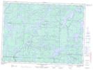
Maps showing Lac Galet, Rivière-Kipawa; Témiscamingue, Quebec
Lac Galet is a Lake located in Rivière-Kipawa; Témiscamingue, Quebec and has an elevation of 364 meters.
- Latitude: 47° 28' 6'' North (decimal: 47.4683333)
- Longitude: 77° 58' 16'' West (decimal: -77.9711111)
- Topography Feature Category: Lake
- Geographical Feature: Lac
- Canadian Province/Territory: Quebec
- Elevation: 364 meters
- Location: Rivière-Kipawa; Témiscamingue
- Atlas of Canada Locator Map: Lac Galet
- GPS Coordinate Locator Map: Lac Galet Lat/Long
Lac Galet NTS Map Sheets