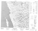
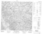
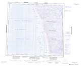
Maps showing Rivière Gassot, Baie-d'Hudson; Kativik, Quebec
Rivière Gassot is a River located in Baie-d'Hudson; Kativik, Quebec.
- Latitude: 57° 44' 00'' North (decimal: 57.7333333)
- Longitude: 76° 54' 26'' West (decimal: -76.9072222)
- Topography Feature Category: River
- Geographical Feature: Rivière
- Canadian Province/Territory: Quebec
- Location: Baie-d'Hudson; Kativik
- Atlas of Canada Locator Map: Rivière Gassot
- GPS Coordinate Locator Map: Rivière Gassot Lat/Long
Rivière Gassot NTS Map Sheets