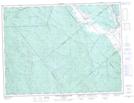
Maps showing Ruisseau Gauche, Saint-Félicien; Le Domaine-du-Roy, Quebec
Ruisseau Gauche is a River located in Saint-Félicien; Le Domaine-du-Roy, Quebec and has an elevation of 124 meters.
- Latitude: 48° 39' 34'' North (decimal: 48.6594775)
- Longitude: 72° 27' 48'' West (decimal: -72.4634154)
- Topography Feature Category: River
- Geographical Feature: Ruisseau
- Canadian Province/Territory: Quebec
- Elevation: 124 meters
- Location: Saint-Félicien; Le Domaine-du-Roy
- Atlas of Canada Locator Map: Ruisseau Gauche
- GPS Coordinate Locator Map: Ruisseau Gauche Lat/Long
Ruisseau Gauche NTS Map Sheets