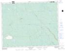
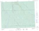
Maps showing Gaudet, Baie-James; Jamésie, Quebec
Gaudet is a Geographical area located in Baie-James; Jamésie, Quebec.
- Latitude: 49° 57' North (decimal: 49.9500000)
- Longitude: 78° 45' West (decimal: -78.7499999)
- Topography Feature Category: Geographical area
- Geographical Feature: Canton
- Canadian Province/Territory: Quebec
- Location: Baie-James; Jamésie
- Atlas of Canada Locator Map: Gaudet
- GPS Coordinate Locator Map: Gaudet Lat/Long
Gaudet NTS Map Sheets