Maps showing Presqu'île Georges-Côté, Baie-James; Jamésie, Quebec
Presqu'île Georges-Côté is a Cape located in Baie-James; Jamésie, Quebec and has an elevation of 390 meters.
- Latitude: 50° 47' 56'' North (decimal: 50.7988889)
- Longitude: 73° 37' 9'' West (decimal: -73.6191667)
- Topography Feature Category: Cape
- Geographical Feature: Presqu'île
- Canadian Province/Territory: Quebec
- Elevation: 390 meters
- Location: Baie-James; Jamésie
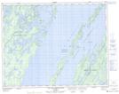
- Atlas of Canada Locator Map: Presqu'île Georges-Côté
- GPS Coordinate Locator Map: Presqu'île Georges-Côté Lat/Long
Presqu'île Georges-Côté NTS Map Sheets