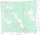
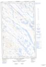
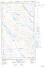
Maps showing Ruisseau Geren, Lac-Vacher; Caniapiscau, Quebec
Ruisseau Geren is a River located in Lac-Vacher; Caniapiscau, Quebec and has an elevation of 518 meters.
- Latitude: 54° 58' 58'' North (decimal: 54.9827778)
- Longitude: 67° 6' 20'' West (decimal: -67.1055556)
- Topography Feature Category: River
- Geographical Feature: Ruisseau
- Canadian Province/Territory: Quebec
- Elevation: 518 meters
- Location: Lac-Vacher; Caniapiscau
- Atlas of Canada Locator Map: Ruisseau Geren
- GPS Coordinate Locator Map: Ruisseau Geren Lat/Long
Ruisseau Geren NTS Map Sheets