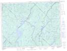
Maps showing Lac Germer, Lac-Croche; La Jacques-Cartier, Quebec
Lac Germer is a Lake located in Lac-Croche; La Jacques-Cartier, Quebec and has an elevation of 454 meters.
- Latitude: 47° 34' 11'' North (decimal: 47.5697222)
- Longitude: 72° 9' 57'' West (decimal: -72.1658333)
- Topography Feature Category: Lake
- Geographical Feature: Lac
- Canadian Province/Territory: Quebec
- Elevation: 454 meters
- Location: Lac-Croche; La Jacques-Cartier
- Atlas of Canada Locator Map: Lac Germer
- GPS Coordinate Locator Map: Lac Germer Lat/Long
Lac Germer NTS Map Sheets