Canada Topographic Maps

Rivière Giraud Topo Maps

Topography maps and Latitude/Longitude Location

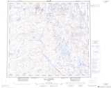
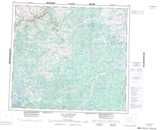
Maps showing Rivière Giraud, Rivière-Koksoak; Kativik, Quebec

Rivière Giraud is a River located in Rivière-Koksoak; Kativik, Quebec.

  • Latitude: 56° 34' 10'' North   (decimal: 56.5695792)
  • Longitude: 69° 36' 33'' West   (decimal: -69.6090761)
  • Topography Feature Category: River
  • Geographical Feature: Rivière
  • Canadian Province/Territory: Quebec
  • Location: Rivière-Koksoak; Kativik
  • Atlas of Canada Locator Map: Rivière Giraud
  • GPS Coordinate Locator Map: Rivière Giraud Lat/Long

Rivière Giraud NTS Map Sheets

024C04 Topographic Map at 1:50,000 scale

024C05 Lac De Noue Topographic Map at 1:50,000 scale

024C12 Topographic Map at 1:50,000 scale

024D01 Lac Forcan Topographic Map at 1:50,000 scale

024C Lac Cambrien Topographic Map at 1:250,000 scale

024D Lac Maricourt Topographic Map at 1:250,000 scale

 
Buy Topographic Maps DVD
Newsletter Sign-up

Yes, I want to receive map store discounts.


Bookmark and Share