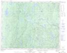
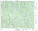
Maps showing Rivière Glapion, Lac-Jérôme; Minganie, Quebec
Rivière Glapion is a River located in Lac-Jérôme; Minganie, Quebec and has an elevation of 457 meters.
- Latitude: 51° 19' 34'' North (decimal: 51.3261738)
- Longitude: 63° 28' 22'' West (decimal: -63.4728719)
- Topography Feature Category: River
- Geographical Feature: Rivière
- Canadian Province/Territory: Quebec
- Elevation: 457 meters
- Location: Lac-Jérôme; Minganie
- Atlas of Canada Locator Map: Rivière Glapion
- GPS Coordinate Locator Map: Rivière Glapion Lat/Long
Rivière Glapion NTS Map Sheets