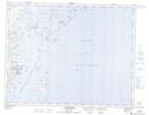
Maps showing Îlot aux Goélands, Gros-Mécatina; Basse-Côte-Nord, Quebec
Îlot aux Goélands is a Island located in Gros-Mécatina; Basse-Côte-Nord, Quebec and has an elevation of 0 meters.
- Latitude: 50° 47' 17'' North (decimal: 50.7881117)
- Longitude: 58° 57' 42'' West (decimal: -58.9616258)
- Topography Feature Category: Island
- Geographical Feature: Îlot / Ilot
- Canadian Province/Territory: Quebec
- Elevation: 0 meters
- Location: Gros-Mécatina; Basse-Côte-Nord
- Atlas of Canada Locator Map: Îlot aux Goélands
- GPS Coordinate Locator Map: Îlot aux Goélands Lat/Long
Îlot aux Goélands NTS Map Sheets