Canada Topographic Maps

Rivière Goodwood Topo Maps

Topography maps and Latitude/Longitude Location

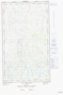
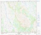
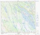
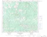
Maps showing Rivière Goodwood, Rivière-Koksoak; Kativik, Quebec

Rivière Goodwood is a River located in Rivière-Koksoak; Kativik, Quebec.

  • Latitude: 55° 34' 44'' North   (decimal: 55.5790050)
  • Longitude: 68° 8' 39'' West   (decimal: -68.1440325)
  • Topography Feature Category: River
  • Geographical Feature: Rivière
  • Canadian Province/Territory: Quebec
  • Location: Rivière-Koksoak; Kativik
  • Atlas of Canada Locator Map: Rivière Goodwood
  • GPS Coordinate Locator Map: Rivière Goodwood Lat/Long

Rivière Goodwood NTS Map Sheets

023N09 Canyon Eaton Topographic Map at 1:50,000 scale

023O03E Lac De La Frontiere Topographic Map at 1:50,000 scale

023O03W Lac De La Frontiere Topographic Map at 1:50,000 scale

023O04E Lac Pailleraut Topographic Map at 1:50,000 scale

023O04W Lac Pailleraut Topographic Map at 1:50,000 scale

023O05 Lac Helluva Topographic Map at 1:50,000 scale

023O12 Lac Wakuach Topographic Map at 1:50,000 scale

023N Riviere Serigny Topographic Map at 1:250,000 scale

023O Lac Wakuach Topographic Map at 1:250,000 scale

 
Buy Topographic Maps DVD
Newsletter Sign-up

Yes, I want to receive map store discounts.


Bookmark and Share