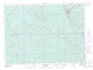
Maps showing Ruisseau Gordon, Témiscaming; Témiscamingue, Quebec
Ruisseau Gordon is a River located in Témiscaming; Témiscamingue, Quebec and has an elevation of 262 meters.
- Latitude: 46° 42' 42'' North (decimal: 46.7117271)
- Longitude: 79° 5' 55'' West (decimal: -79.0986968)
- Topography Feature Category: River
- Geographical Feature: Ruisseau
- Canadian Province/Territory: Quebec
- Elevation: 262 meters
- Location: Témiscaming; Témiscamingue
- Atlas of Canada Locator Map: Ruisseau Gordon
- GPS Coordinate Locator Map: Ruisseau Gordon Lat/Long
Ruisseau Gordon NTS Map Sheets