Canada Topographic Maps

Rivière du Gouffre Topo Maps

Topography maps and Latitude/Longitude Location

Maps showing Rivière du Gouffre, Baie-Saint-Paul; Charlevoix, Quebec

Rivière du Gouffre is a River located in Baie-Saint-Paul; Charlevoix, Quebec and has an elevation of 416 meters.

  • Latitude: 47° 25' 53'' North   (decimal: 47.4314112)
  • Longitude: 70° 29' 17'' West   (decimal: -70.4881336)
  • Topography Feature Category: River
  • Geographical Feature: Rivière
  • Canadian Province/Territory: Quebec
  • Elevation: 416 meters
  • Location: Baie-Saint-Paul; Charlevoix
  • Atlas of Canada Locator Map: Rivière du Gouffre
  • GPS Coordinate Locator Map: Rivière du Gouffre Lat/Long

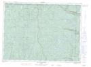
Rivière du Gouffre NTS Map Sheets

021M07 Maillard Topographic Map at 1:50,000 scale

021M08 Ile Aux Coudres Topographic Map at 1:50,000 scale

021M09 La Malbaie Topographic Map at 1:50,000 scale

021M10 Saint-Urbain Topographic Map at 1:50,000 scale

021M15 Lac Des Martres Topographic Map at 1:50,000 scale

021M16 Lac Au Plongeon Topographic Map at 1:50,000 scale

021M Baie-Saint-Paul Topographic Map at 1:250,000 scale

 
Buy Topographic Maps DVD
Newsletter Sign-up

Yes, I want to receive map store discounts.


Bookmark and Share