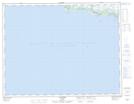
Maps showing Brisants Goynish, Aguanish; Minganie, Quebec
Brisants Goynish is a Shoal located in Aguanish; Minganie, Quebec.
- Latitude: 50° 12' 14'' North (decimal: 50.2039611)
- Longitude: 62° 4' 36'' West (decimal: -62.0767666)
- Topography Feature Category: Shoal
- Geographical Feature: Brisants
- Canadian Province/Territory: Quebec
- Location: Aguanish; Minganie
- GPS Coordinate Locator Map: Brisants Goynish Lat/Long
Brisants Goynish NTS Map Sheets