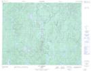
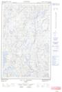
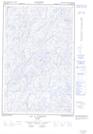
Maps showing Rivière du Grand Brûlé, Rivière-aux-Outardes; Manicouagan, Quebec
Rivière du Grand Brûlé is a River located in Rivière-aux-Outardes; Manicouagan, Quebec and has an elevation of 566 meters.
- Latitude: 50° 33' 4'' North (decimal: 50.5511943)
- Longitude: 69° 37' 5'' West (decimal: -69.6181626)
- Topography Feature Category: River
- Geographical Feature: Rivière
- Canadian Province/Territory: Quebec
- Elevation: 566 meters
- Location: Rivière-aux-Outardes; Manicouagan
- Atlas of Canada Locator Map: Rivière du Grand Brûlé
- GPS Coordinate Locator Map: Rivière du Grand Brûlé Lat/Long
Rivière du Grand Brûlé NTS Map Sheets