Canada Topographic Maps

Grand-Remous Topo Maps

Topography maps and Latitude/Longitude Location

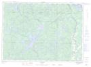
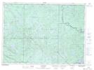
Maps showing Grand-Remous, Grand-Remous; La Vallée-de-la-Gatineau, Quebec

Grand-Remous is a Village located in Grand-Remous; La Vallée-de-la-Gatineau, Quebec.

  • Latitude: 46° 37' North   (decimal: 46.6166668)
  • Longitude: 75° 54' West   (decimal: -75.8999998)
  • Topography Feature Category: Village
  • Geographical Feature: Municipalité de canton
  • Canadian Province/Territory: Quebec
  • Location: Grand-Remous; La Vallée-de-la-Gatineau
  • Atlas of Canada Locator Map: Grand-Remous
  • GPS Coordinate Locator Map: Grand-Remous Lat/Long

Grand-Remous NTS Map Sheets

031J11 Ferme-Neuve Topographic Map at 1:50,000 scale

031J12 Grand-Remous Topographic Map at 1:50,000 scale

031J13 Reservoir Baskatong Topographic Map at 1:50,000 scale

031K09 Montcerf Topographic Map at 1:50,000 scale

031K16 Lac Kellog Topographic Map at 1:50,000 scale

031J Mont-Laurier Topographic Map at 1:250,000 scale

031K Deep River Topographic Map at 1:250,000 scale

 
Buy Topographic Maps DVD
Newsletter Sign-up

Yes, I want to receive map store discounts.


Bookmark and Share