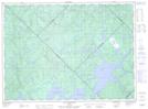
Maps showing Île Green, La Tuque; La Tuque, Quebec
Île Green is a Island located in La Tuque; La Tuque, Quebec and has an elevation of 396 meters.
- Latitude: 47° 34' 45'' North (decimal: 47.5792258)
- Longitude: 74° 7' 8'' West (decimal: -74.119024)
- Topography Feature Category: Island
- Geographical Feature: Île / Ile
- Canadian Province/Territory: Quebec
- Elevation: 396 meters
- Location: La Tuque; La Tuque
- Atlas of Canada Locator Map: Île Green
- GPS Coordinate Locator Map: Île Green Lat/Long
Île Green NTS Map Sheets