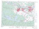
Maps showing La Grosse Décharge, Lac-Ministuk; Le Fjord-du-Saguenay, Quebec
La Grosse Décharge is a River located in Lac-Ministuk; Le Fjord-du-Saguenay, Quebec and has an elevation of 174 meters.
- Latitude: 48° 16' 33'' North (decimal: 48.2758729)
- Longitude: 70° 58' 24'' West (decimal: -70.9734194)
- Topography Feature Category: River
- Geographical Feature: Ruisseau
- Canadian Province/Territory: Quebec
- Elevation: 174 meters
- Location: Lac-Ministuk; Le Fjord-du-Saguenay
- Atlas of Canada Locator Map: La Grosse Décharge
- GPS Coordinate Locator Map: La Grosse Décharge Lat/Long
La Grosse Décharge NTS Map Sheets