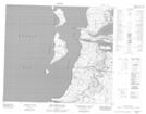
Maps showing Chenal Gulf Hazard, Baie-d'Hudson; Kativik, Quebec
Chenal Gulf Hazard is a Channel located in Baie-d'Hudson; Kativik, Quebec.
- Latitude: 56° 9' 43'' North (decimal: 56.1619444)
- Longitude: 76° 36' 57'' West (decimal: -76.6158333)
- Topography Feature Category: Channel
- Geographical Feature: Chenal
- Canadian Province/Territory: Quebec
- Location: Baie-d'Hudson; Kativik
- GPS Coordinate Locator Map: Chenal Gulf Hazard Lat/Long
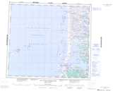
Chenal Gulf Hazard NTS Map Sheets