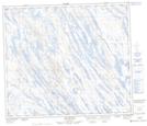
Maps showing Lac Gustafson, Rivière-Koksoak; Kativik, Quebec
Lac Gustafson is a Lake located in Rivière-Koksoak; Kativik, Quebec and has an elevation of 489 meters.
- Latitude: 55° 26' 13'' North (decimal: 55.4370493)
- Longitude: 66° 40' 54'' West (decimal: -66.6817791)
- Topography Feature Category: Lake
- Geographical Feature: Lac
- Canadian Province/Territory: Quebec
- Elevation: 489 meters
- Location: Rivière-Koksoak; Kativik
- Atlas of Canada Locator Map: Lac Gustafson
- GPS Coordinate Locator Map: Lac Gustafson Lat/Long
Lac Gustafson NTS Map Sheets