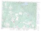
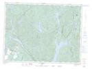
Maps showing Rivière des Habitants, Labrecque; Lac-Saint-Jean-Est, Quebec
Rivière des Habitants is a River located in Labrecque; Lac-Saint-Jean-Est, Quebec and has an elevation of 150 meters.
- Latitude: 48° 40' 42'' North (decimal: 48.6783788)
- Longitude: 71° 25' 1'' West (decimal: -71.4170403)
- Topography Feature Category: River
- Geographical Feature: Rivière
- Canadian Province/Territory: Quebec
- Elevation: 150 meters
- Location: Labrecque; Lac-Saint-Jean-Est
- Atlas of Canada Locator Map: Rivière des Habitants
- GPS Coordinate Locator Map: Rivière des Habitants Lat/Long
Rivière des Habitants NTS Map Sheets