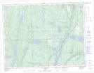
Maps showing Lac Hall, Lac-Walker; Sept-Rivières, Quebec
Lac Hall is a Lake located in Lac-Walker; Sept-Rivières, Quebec and has an elevation of 119 meters.
- Latitude: 50° 16' 51'' North (decimal: 50.2808830)
- Longitude: 66° 34' 42'' West (decimal: -66.5782540)
- Topography Feature Category: Lake
- Geographical Feature: Lac
- Canadian Province/Territory: Quebec
- Elevation: 119 meters
- Location: Lac-Walker; Sept-Rivières
- Atlas of Canada Locator Map: Lac Hall
- GPS Coordinate Locator Map: Lac Hall Lat/Long
Lac Hall NTS Map Sheets