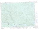
Maps showing Petit ruisseau Hanwell, Rivière-Kipawa; Témiscamingue, Quebec
Petit ruisseau Hanwell is a River located in Rivière-Kipawa; Témiscamingue, Quebec and has an elevation of 365 meters.
- Latitude: 46° 16' 3'' North (decimal: 46.2675596)
- Longitude: 78° 7' 4'' West (decimal: -78.1178197)
- Topography Feature Category: River
- Geographical Feature: Ruisseau
- Canadian Province/Territory: Quebec
- Elevation: 365 meters
- Location: Rivière-Kipawa; Témiscamingue
- Atlas of Canada Locator Map: Petit ruisseau Hanwell
- GPS Coordinate Locator Map: Petit ruisseau Hanwell Lat/Long
Petit ruisseau Hanwell NTS Map Sheets