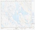
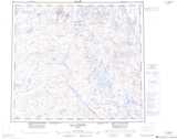
Maps showing Les Hautes Chutes, Rivière-Koksoak; Kativik, Quebec
Les Hautes Chutes is a Falls located in Rivière-Koksoak; Kativik, Quebec.
- Latitude: 56° 6' 26'' North (decimal: 56.1073475)
- Longitude: 68° 19' 40'' West (decimal: -68.3276522)
- Topography Feature Category: Falls
- Geographical Feature: Chutes
- Canadian Province/Territory: Quebec
- Location: Rivière-Koksoak; Kativik
- Atlas of Canada Locator Map: Les Hautes Chutes
- GPS Coordinate Locator Map: Les Hautes Chutes Lat/Long
Les Hautes Chutes NTS Map Sheets