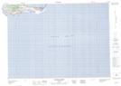
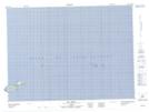
Maps showing Île du Havre Aubert, Les Îles-de-la-Madeleine; Les Îles-de-la-Madeleine, Quebec
Île du Havre Aubert is a Island located in Les Îles-de-la-Madeleine; Les Îles-de-la-Madeleine, Quebec and has an elevation of 42 meters.
- Latitude: 47° 14' North (decimal: 47.2333000)
- Longitude: 61° 57' West (decimal: -61.9499999)
- Topography Feature Category: Island
- Geographical Feature: Île / Ile
- Canadian Province/Territory: Quebec
- Elevation: 42 meters
- Location: Les Îles-de-la-Madeleine; Les Îles-de-la-Madeleine
- Atlas of Canada Locator Map: Île du Havre Aubert
- GPS Coordinate Locator Map: Île du Havre Aubert Lat/Long
Île du Havre Aubert NTS Map Sheets