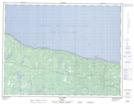
Maps showing Havre-du-Brick, L'Île-d'Anticosti; Minganie, Quebec
Havre-du-Brick is a Miscellaneous campsite located in L'Île-d'Anticosti; Minganie, Quebec and has an elevation of 23 meters.
- Latitude: 49° 51' 10'' North (decimal: 49.8528427)
- Longitude: 63° 38' 23'' West (decimal: -63.6395914)
- Topography Feature Category: Miscellaneous campsite
- Geographical Feature: Camp sportif
- Canadian Province/Territory: Quebec
- Elevation: 23 meters
- Location: L'Île-d'Anticosti; Minganie
- Atlas of Canada Locator Map: Havre-du-Brick
- GPS Coordinate Locator Map: Havre-du-Brick Lat/Long
Havre-du-Brick NTS Map Sheets