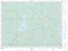
Maps showing Ruisseau Hell Diver, La Tuque; Le Haut-Saint-Maurice, Quebec
Ruisseau Hell Diver is a River located in La Tuque; Le Haut-Saint-Maurice, Quebec.
- Latitude: 47° 50' 38'' North (decimal: 47.8439594)
- Longitude: 74° 49' 53'' West (decimal: -74.8312593)
- Topography Feature Category: River
- Geographical Feature: Ruisseau
- Canadian Province/Territory: Quebec
- Location: La Tuque; Le Haut-Saint-Maurice
- GPS Coordinate Locator Map: Ruisseau Hell Diver Lat/Long