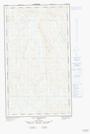
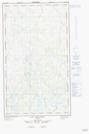
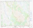
Maps showing Ruisseau Helluva, Rivière-Koksoak; Kativik, Quebec
Ruisseau Helluva is a River located in Rivière-Koksoak; Kativik, Quebec.
- Latitude: 55° 13' 3'' North (decimal: 55.2176033)
- Longitude: 67° 32' 48'' West (decimal: -67.5467910)
- Topography Feature Category: River
- Geographical Feature: Ruisseau
- Canadian Province/Territory: Quebec
- Location: Rivière-Koksoak; Kativik
- Atlas of Canada Locator Map: Ruisseau Helluva
- GPS Coordinate Locator Map: Ruisseau Helluva Lat/Long
Ruisseau Helluva NTS Map Sheets