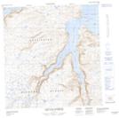
Maps showing The Helmet, Rivière-Koksoak; Kativik, Quebec
The Helmet is a Mountain located in Rivière-Koksoak; Kativik, Quebec.
- Latitude: 61° 53' 48'' North (decimal: 61.8966612)
- Longitude: 72° 37' 6'' West (decimal: -72.6183563)
- Topography Feature Category: Mountain
- Geographical Feature: Colline
- Canadian Province/Territory: Quebec
- Location: Rivière-Koksoak; Kativik
- Atlas of Canada Locator Map: The Helmet
- GPS Coordinate Locator Map: The Helmet Lat/Long
The Helmet NTS Map Sheets