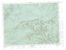
Maps showing Lac du Huard, Ruisseau-des-Mineurs; La Matapédia, Quebec
Lac du Huard is a Lake located in Ruisseau-des-Mineurs; La Matapédia, Quebec and has an elevation of 213 meters.
- Latitude: 48° 37' 42'' North (decimal: 48.6283795)
- Longitude: 66° 24' 14'' West (decimal: -66.4038454)
- Topography Feature Category: Lake
- Geographical Feature: Lac
- Canadian Province/Territory: Quebec
- Elevation: 213 meters
- Location: Ruisseau-des-Mineurs; La Matapédia
- Atlas of Canada Locator Map: Lac du Huard
- GPS Coordinate Locator Map: Lac du Huard Lat/Long