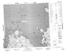
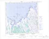
Maps showing Pointe Hubbard, Rivière-Koksoak; Kativik, Quebec
Pointe Hubbard is a Cape located in Rivière-Koksoak; Kativik, Quebec.
- Latitude: 58° 49' 45'' North (decimal: 58.8291667)
- Longitude: 66° 27' 8'' West (decimal: -66.4522222)
- Topography Feature Category: Cape
- Geographical Feature: Pointe
- Canadian Province/Territory: Quebec
- Location: Rivière-Koksoak; Kativik
- Atlas of Canada Locator Map: Pointe Hubbard
- GPS Coordinate Locator Map: Pointe Hubbard Lat/Long
Pointe Hubbard NTS Map Sheets