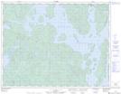
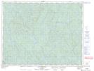
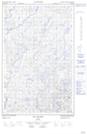
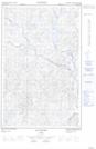
Maps showing Rivière Hulot, Rivière-aux-Outardes; Manicouagan, Quebec
Rivière Hulot is a River located in Rivière-aux-Outardes; Manicouagan, Quebec and has an elevation of 365 meters.
- Latitude: 50° 13' 6'' North (decimal: 50.2183333)
- Longitude: 69° 23' 28'' West (decimal: -69.3911111)
- Topography Feature Category: River
- Geographical Feature: Rivière
- Canadian Province/Territory: Quebec
- Elevation: 365 meters
- Location: Rivière-aux-Outardes; Manicouagan
- Atlas of Canada Locator Map: Rivière Hulot
- GPS Coordinate Locator Map: Rivière Hulot Lat/Long
Rivière Hulot NTS Map Sheets