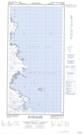
Maps showing Lac Igussaaraq, Rivière-Koksoak; Kativik, Quebec
Lac Igussaaraq is a Lake located in Rivière-Koksoak; Kativik, Quebec.
- Latitude: 60° 15' 21'' North (decimal: 60.2557589)
- Longitude: 69° 43' 10'' West (decimal: -69.7194706)
- Topography Feature Category: Lake
- Geographical Feature: Lac
- Canadian Province/Territory: Quebec
- Location: Rivière-Koksoak; Kativik
- GPS Coordinate Locator Map: Lac Igussaaraq Lat/Long
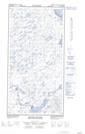
Lac Igussaaraq NTS Map Sheets