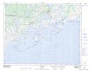
Maps showing L'Île-du-Vieux-Fort, Bonne-Espérance; Basse-Côte-Nord, Quebec
L'Île-du-Vieux-Fort is a Unincorporated area located in Bonne-Espérance; Basse-Côte-Nord, Quebec and has an elevation of 2 meters.
- Latitude: 51° 22' 4'' North (decimal: 51.3678316)
- Longitude: 57° 47' 8'' West (decimal: -57.7854715)
- Topography Feature Category: Unincorporated area
- Geographical Feature: Lieu-dit
- Canadian Province/Territory: Quebec
- Elevation: 2 meters
- Location: Bonne-Espérance; Basse-Côte-Nord
- Atlas of Canada Locator Map: L'Île-du-Vieux-Fort
- GPS Coordinate Locator Map: L'Île-du-Vieux-Fort Lat/Long
L'Île-du-Vieux-Fort NTS Map Sheets