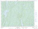
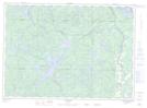
Maps showing Lac des Îles, Rivière-aux-Outardes; Manicouagan, Quebec
Lac des Îles is a Lake located in Rivière-aux-Outardes; Manicouagan, Quebec and has an elevation of 335 meters.
- Latitude: 50° 9' 57'' North (decimal: 50.1658333)
- Longitude: 68° 23' 41'' West (decimal: -68.3947222)
- Topography Feature Category: Lake
- Geographical Feature: Lac
- Canadian Province/Territory: Quebec
- Elevation: 335 meters
- Location: Rivière-aux-Outardes; Manicouagan
- Atlas of Canada Locator Map: Lac des Îles
- GPS Coordinate Locator Map: Lac des Îles Lat/Long
Lac des Îles NTS Map Sheets