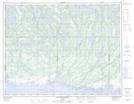
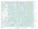
Maps showing Lac des Îles, Lac-Jérôme; Minganie, Quebec
Lac des Îles is a Lake located in Lac-Jérôme; Minganie, Quebec.
- Latitude: 50° 30' 9'' North (decimal: 50.5025701)
- Longitude: 62° 47' 22'' West (decimal: -62.7895600)
- Topography Feature Category: Lake
- Geographical Feature: Lac
- Canadian Province/Territory: Quebec
- Location: Lac-Jérôme; Minganie
- GPS Coordinate Locator Map: Lac des Îles Lat/Long
Lac des Îles NTS Map Sheets