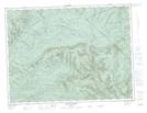
Maps showing Ruisseau de l'Indien, Rivière-Bonjour; Matane, Quebec
Ruisseau de l'Indien is a River located in Rivière-Bonjour; Matane, Quebec and has an elevation of 201 meters.
- Latitude: 48° 41' 56'' North (decimal: 48.6989357)
- Longitude: 66° 14' 8'' West (decimal: -66.2355071)
- Topography Feature Category: River
- Geographical Feature: Ruisseau
- Canadian Province/Territory: Quebec
- Elevation: 201 meters
- Location: Rivière-Bonjour; Matane
- Atlas of Canada Locator Map: Ruisseau de l'Indien
- GPS Coordinate Locator Map: Ruisseau de l'Indien Lat/Long
Ruisseau de l'Indien NTS Map Sheets