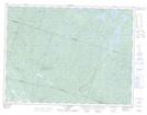
Maps showing Ruisseau Ireland, Mont-Valin; Le Fjord-du-Saguenay, Quebec
Ruisseau Ireland is a River located in Mont-Valin; Le Fjord-du-Saguenay, Quebec.
- Latitude: 48° 32' 58'' North (decimal: 48.5494444)
- Longitude: 70° 45' 35'' West (decimal: -70.7597222)
- Topography Feature Category: River
- Geographical Feature: Ruisseau
- Canadian Province/Territory: Quebec
- Location: Mont-Valin; Le Fjord-du-Saguenay
- GPS Coordinate Locator Map: Ruisseau Ireland Lat/Long
Ruisseau Ireland NTS Map Sheets