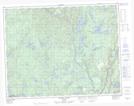
Maps showing Lac Irène, Rivière-Nipissis; Sept-Rivières, Quebec
Lac Irène is a Lake located in Rivière-Nipissis; Sept-Rivières, Quebec.
- Latitude: 50° 41' 16'' North (decimal: 50.6877778)
- Longitude: 66° 4' 56'' West (decimal: -66.0822222)
- Topography Feature Category: Lake
- Geographical Feature: Lac
- Canadian Province/Territory: Quebec
- Location: Rivière-Nipissis; Sept-Rivières
- GPS Coordinate Locator Map: Lac Irène Lat/Long
Lac Irène NTS Map Sheets